
Flood Protection
Floodwaters can rise very fast with little warning.
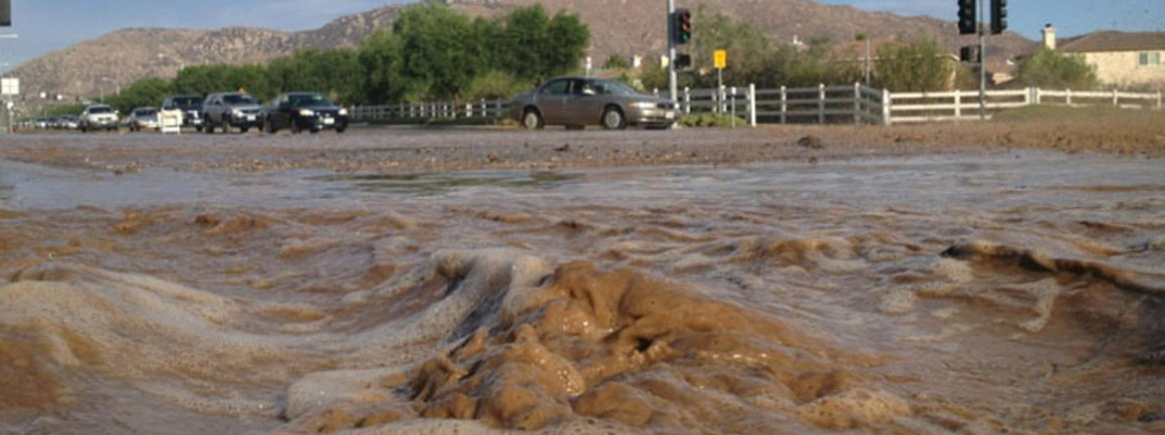
Mud and flooding in Moreno Valley.
Flood Assistance
Land Development Division staff are available to discuss any flood problems you may have and explain ways to protect your property. Call the Land Development Division at 951.413.3120.
A January 2010 storm caused flooding in many areas of the City. Especially hard hit areas were in the vicinity of Heacock St south of Cactus Ave. Later that year in December a storm again caused flooding in the City. Especially hard hit areas were in the vicinity of Day St. at Alessandro Blvd.
Floods can come with little warning. Even though they appear to move slowly (three feet per second), a flood two feet deep can knock a person off their feet and even float a car. If you are in a floodplain the odds are that someday your property will be damaged. The tabs below give you some ideas of what you can do to protect yourself.
A Note About Flood Warnings
There is NO detailed flood warning system available at this time. The National Weather Service broadcasts "flash flood warnings," on radio and television when storms are predicted. These warnings are general in nature and do not include precise locations.
Resources
-
Flood Zones and Hazard Maps
The first thing you should do is check your flood hazard. Flood hazard maps and flood protection references are available at City Hall and the City Library. The flood hazard areas, which are also called 100 - year floodplains, are shown on Flood Insurance Rate Maps. The 100 - year floodplain is the area that has a 1 % probability of being flooded in any given year.
- Copies of elevation certificates can be obtained from the Land Development Division Counter
- Additional flood protection information can be found in the Moreno Valley Library
List of Flood Zones
The following is a list of the different FIRM zones.
Zone A No Base Flood Elevations determined. Zone AE Flood Elevations determined. Zone AH Flood depths of 1 to 3 feet; Base Flood Elevations determined. Zone AO Flood depths of 1 to 3 feet; average depths determined. Zone AR Special Flood Hazard Area formerly protects from the 1 % annual chance flood by a flood control system that was subsequently decertified. Zone AR indicates that the former flood control system is being restored to provide protection from the 1 % annual chance or greater flood Zone A99 Area to be protected from 1 % annual chance flood by a Federal flood protection system under construction; no base Flood Elevations determined. Zone V Costal flood zone with velocity hazard (wave action); no Base Flood Elevations determined. Zone VE Costal flood zone with velocity hazard (wave action); Base Flood Elevations determined. Zone X (shaded)-Areas of 0.2% annual chance flood; areas of 1 % annual chance flood with average depths of less than 1 foot or with drainage areas less than 1 sq. mile; and areas protected by levees from 1 % annual chance flood. Zone X Areas determined to be outside the 0.2% annual chance floodplain. Zone D Areas in which flood hazards are undetermined, but possible. The Special Flood Hazard Areas (SFHA) are Zone A, AE, AH AO, AR, A99, V & VE. -
Flood Insurance
Your homeowner's insurance policy will not cover losses due to flooding. However, because the City of Moreno Valley participates in the National Flood Insurance Program, you can purchase a separate flood insurance policy. Moreno Valley has received a Class Eight rating for flood insurance through the Community Rating System. The City's participation in the Community Rating System gives property owners a 10% discount on their flood insurance. This insurance is available to everyone, even for properties that have been flooded.
For many people, their home and its contents represent their greatest investment. You need to consider the purchase of flood insurance to protect yourself from devastating losses due to flooding. Property owners can insure their buildings and contents, and renters can insure their possessions. In most cases, there is a 30-day period after you purchase a flood policy before coverage is in effect, so don't wait until a flood is threatening. Information about flood insurance can be obtained from your insurance agent. If you don't have an agent, or your agent does not write flood insurance, the NFIP has a toll-free number for agent referrals 800.225.5356. You can also get more details about flood insurance at Floodsmart.gov.
In contrast to flood insurance, federal disaster assistance requires a Presidential declaration and occurs in less than 50% of flooding events. Furthermore, federal assistance is typically a loan that must be repaid with interest. Therefore, consideration should be given to acquiring flood insurance to protect against flood losses.
-
Flood Safety Tips
- Know the locations on your property that might be dangerous during a flood.
- Plan escape routes to high ground.
- During times of heavy rainfall, monitor the level of water in the drainageway.
- Evacuate the flood area when advised by the police or fire department.
- Do not attempt to cross a flooding stream, roadway or standing water on foot or by car unless you know the depth. Remember the flood may have washed out the normal ground level.
- Keep children away from flood waters, ditches and storm drains.
- Be especially cautious at night.
- Stay away from power lines and electrical wires.
- Look out for animals.
- Be alert for gas leaks.
For additional information visit the FEMA website.
-
Elevation Certificates
If your home or business is in a high-risk area, you will likely need an Elevation Certificate (EC). An Elevation Certificate documents important features of your property, including its location, flood zone, building characteristics and, most importantly, the elevation of its lowest floor.
An Elevation Certification is needed to know your building’s elevation compared to the estimated height floodwaters will reach in a major flood helps provide a true picture of the status of compliance with floodplain ordinances so as to determine your flood risk and the cost of your flood insurance premium.
Moreno Valley keeps a list of addresses with elevation certificates. To obtain a copy of an elevation certificate, contact Land Development by phone at 951.431.3120 or by email at landdevelopment@moval.org.
-
Dam Inundation Map
An Inundation map shows flooding that could result from a hypothetical failure of a dam or its critical appurtenant structure.